January 2025
January 31st: More on mapping
I have long kept up-to-date with what the inspirational Alan Parkinson’s posts on his LivingGeography blog and was intrigued when I saw him share this podcast titled 'Wherefore the map? with Ed Parsons’. Having very much enjoyed Ed Parson’s recent RGS lecture (see below), I sat down to enjoy this podcast and hear more about mapping and our changing relationships with maps.
What was of particular interest however was their discussion of the Mercator projection and, they explain, the nuance with which we need to discuss this projection. It gave me plenty of food for thought and made my realise that perhaps I had previously had a misconception about the colonial bias of this projection.
The notes I took whilst listening to the podcast are below.
Notes:
The Mercator projection keeps angles- it was a tool for navigation
But, the disadvantage of this is that you lose is ‘areal fidelity’
Many of the criticisms of the Mercator projection today are that it is a colonial representation of the world- it emphasises the importance of Europe compared to the rest of the world
But, we can’t go back and ask Mercator if that was what he was trying to do- and almost certainly he wasn’t aiming for this- this is our modern interpretation of it- that it is a Western bias of the world
Today, many say that the centre of the Mercator projection is on Europe
But, really it’s on the Atlantic and the title says it is for use in navigation.
Of course, implicit in this, navigation is a European move (at this time) but it doesn’t have Europe at its centre- it’s a bit lazy to call it ’Euro-centric’
Perhaps Mercator was thinking ‘who are the users of this map?’ and designing it as such- ‘my users are navigators and therefore I need to meet their needs of navigation’
My reflections:
Has my previous thinking about Mercator’s projection (that it was purposeful Western bias and colonialist) been overly-simplistic? If the argument above is correct, how would I explain this nuance to sixth-formers when teaching or discussing map projections?
January 27th: A curriculum first…
Early 2025 has seen a curriculum first for me as we explicitly teach about rewilding for the first time at Key Stage 3. This is something I’ve thought about introducing for a while but needed to consider how and where best to do it- and what the core knowledge of teaching rewilding would be. We’ve introduced it in our UK study of Year 7 with a title of ‘What is rewilding and what could it mean for the UK?’
When thinking about which example to use in the classroom, there are so many great examples of projects to choose from. Perhaps the most famous rewilding project in the UK is Knepp but I knew I wanted to use a high-quality video clip to bring this issue to life for students and, sadly, Knepp doesn’t yet have any education resources. In the end, I settled on using this clip from BBC Teach because, although it’s a few years old, it’s an excellent clip that clearly sets out the debate around introducing lynx to the UK.
Other excellent resources that I considered using include:
The Cairngorms Connect project
Landscape change lesson plans from Forestry England
Newsround introduction to Rewilding
In terms of what we’re teaching about rewilding, below is the core knowledge of our lesson. It fits within our exploration of human and physical processes that have shaped the UK landscape and follows on from students learning about how humans have shaped the UK landscape through deforestation, agriculture and settlement. It therefore felt right to look at this growing movement and what it aims to do:
- Rewilding is an approach to return a landscape to a more natural form.
- The main aim of rewilding is to increase biodiversity by reintroducing plant and animals species that are no longer found there.
- Biodiversity is the number of different plant and animal species in a given area.

January 16th: Reflecting on our trust A-Level residential
Our first cross-trust A-Level residential, my first visit to Flatford Mill, and my first time doing fieldwork with temperatures of 0 degrees… Now that I’ve thawed out, I wanted to reflect on a wonderful few days at FSC Flatford Mill and share what we did. I’ve shared other ideas, and resources for, fieldwork here.
The start of the new term saw 40 A-Level geographers from 5 of our 7 schools travel to the rural Essex / Suffolk border for our first cross-trust geography enrichment residential. I was really excited to lead this in my role as Trust Lead and to have (hopefully) have this as a key part of our A-Level geography offer going forward.
Having arrived at the Flatford Mill field study centre, the trip begun with an afternoon of fieldwork in Dedham. Students investigated the extent to which Dedham Vale can be represented and perceived in different ways using a range of different fieldwork methods to investigate the beautiful village. They took photos, listened to the soundscape around them, and mapped their emotional responses to the different spaces of the village- a stark contrast to the urban environments that many of them are used to! With some rich data collected, it was back to the classroom for an evening of data presentation, analysis and conclusions.
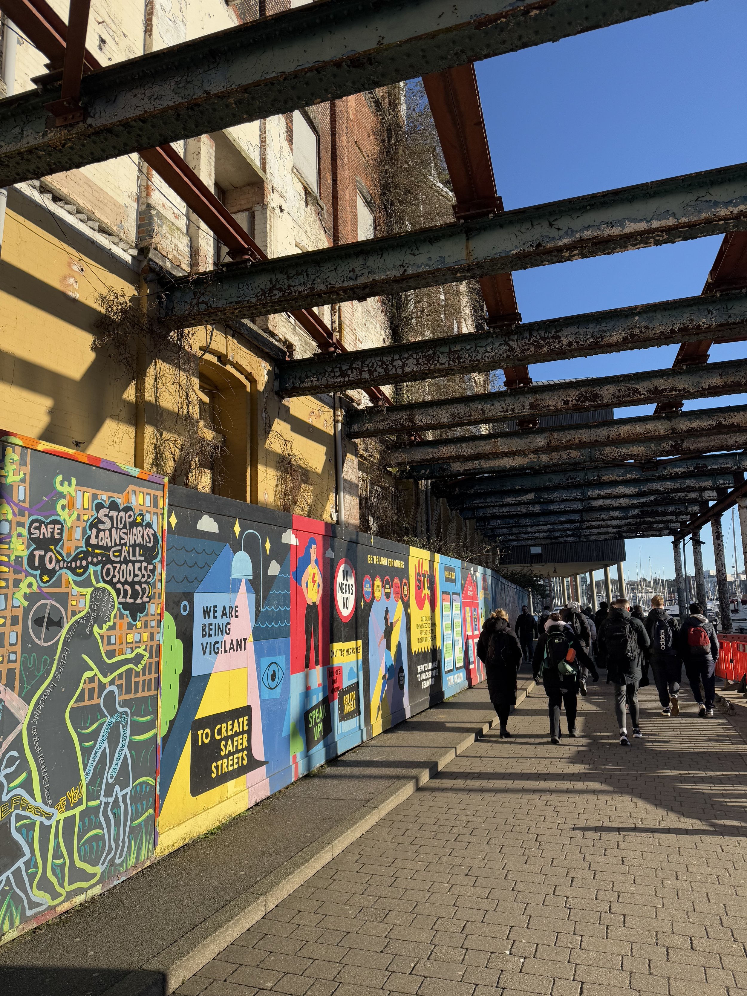
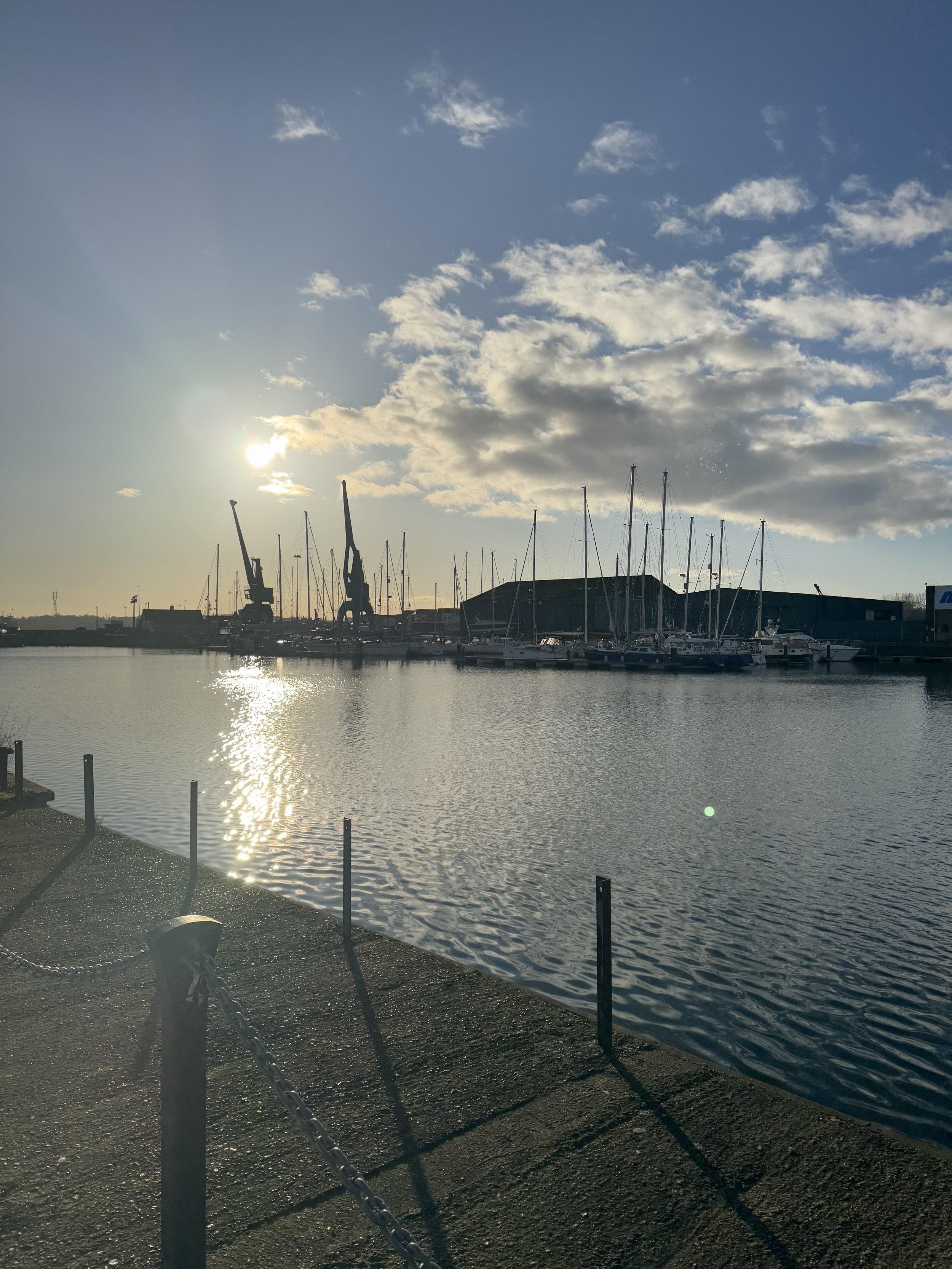
Day 2 dawned crisp and bright. We started in the classrooms of Flatford Mill where we looked at the context of Ipswich and what we could investigate when visiting the Ipswich Waterfront area. We looked at secondary census data, blog posts, and newspaper articles to gain a sense of place before heading out into the field. Although cold, it was a beautiful day down at the marina and all of our students threw themselves into an afternoon of data collection that included a land-use survey, Environmental Quality Surveys and, of course, some questionnaires- the geography fieldwork classic.
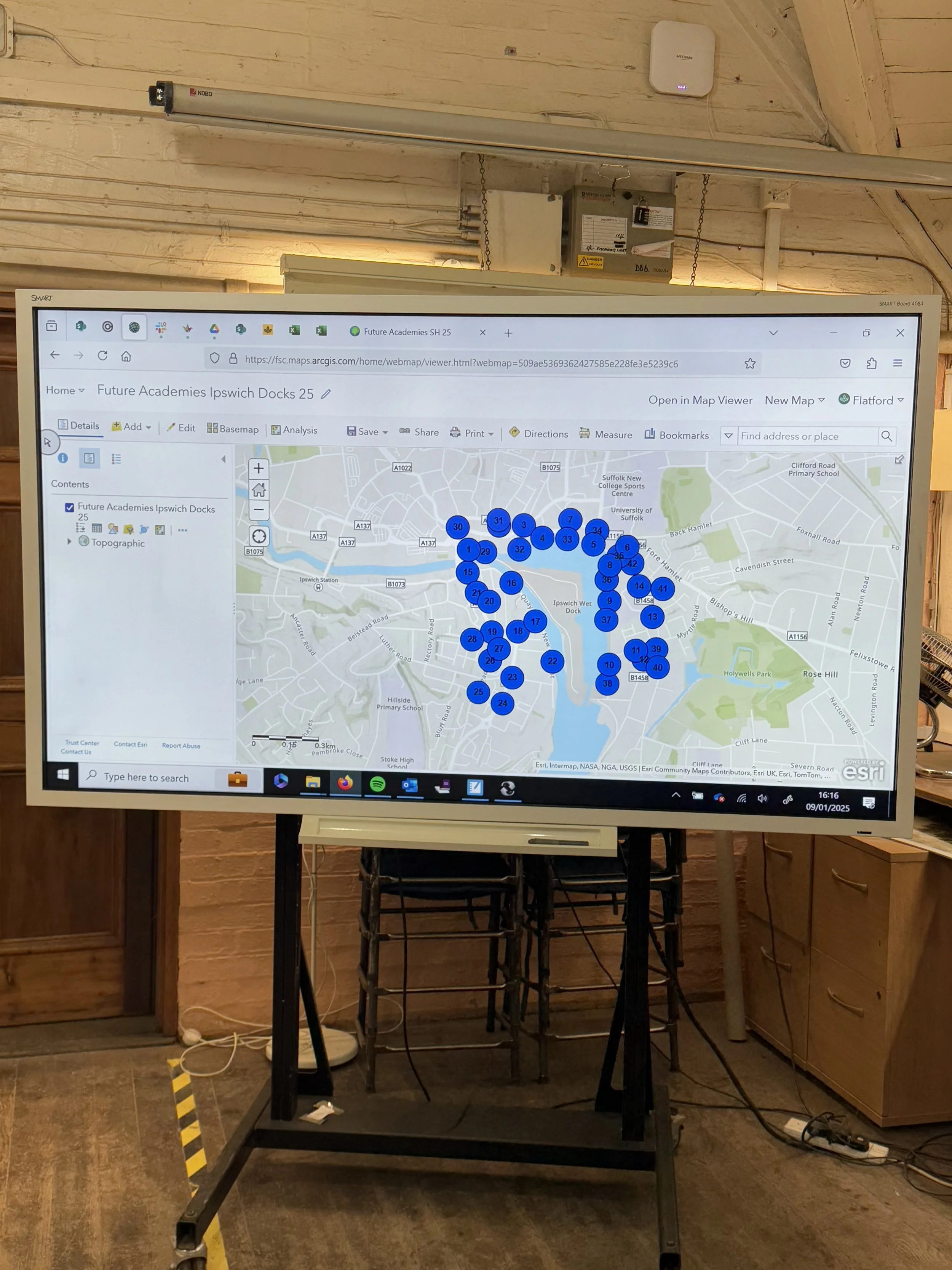
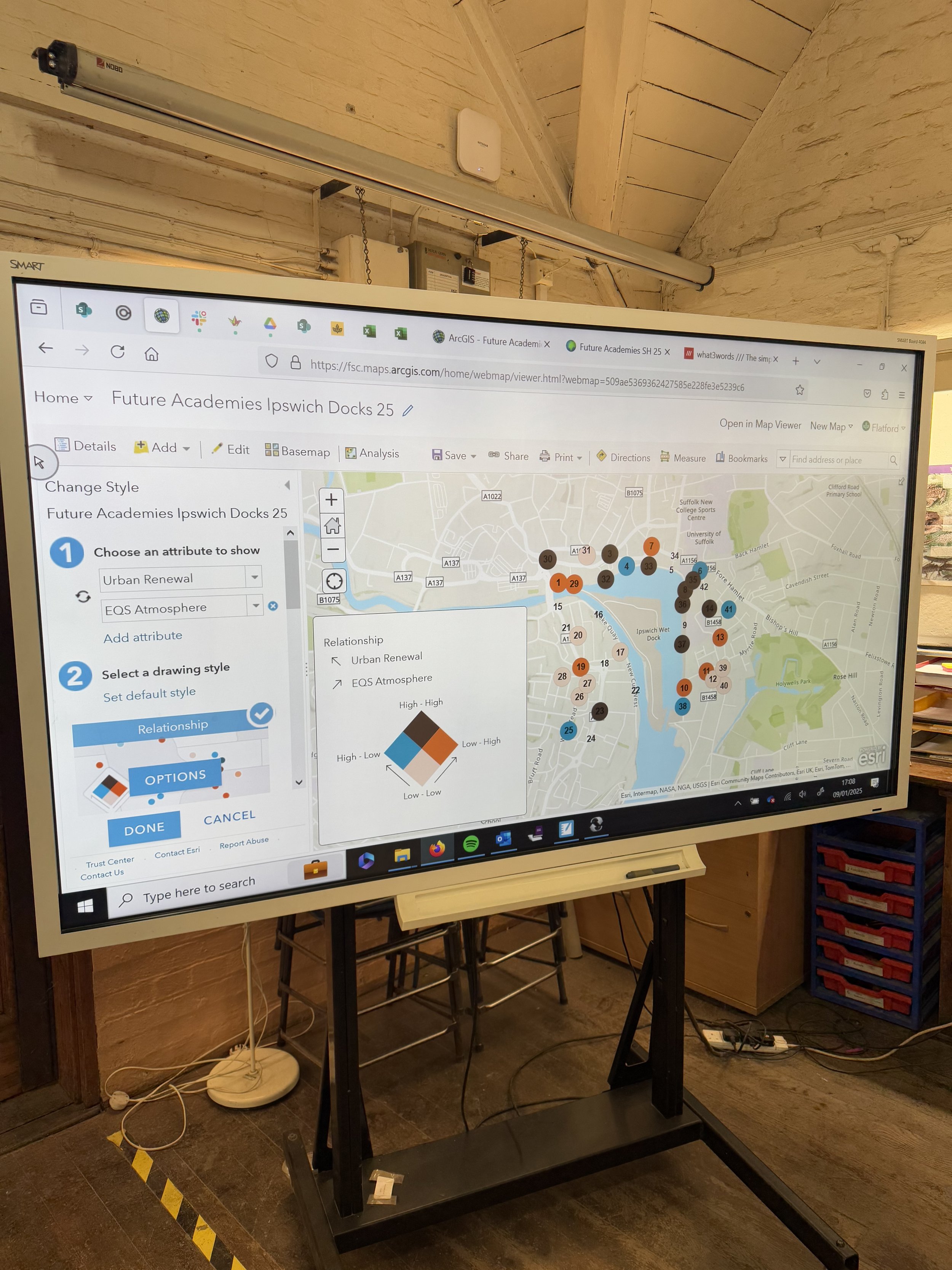
Back at Flatford Mill we warmed up with hot drinks and some free time before returning to the classroom to present our data using GIS. We learnt how to use ArcGIS and how we can layer our data onto a map to enable high-quality analysis. With our learning for Day 2 finished, it was quiz and game time. Students from different schools teamed up to answer geographical questions, complete some geographical dingbats and play multiple rounds of Uno and card games.
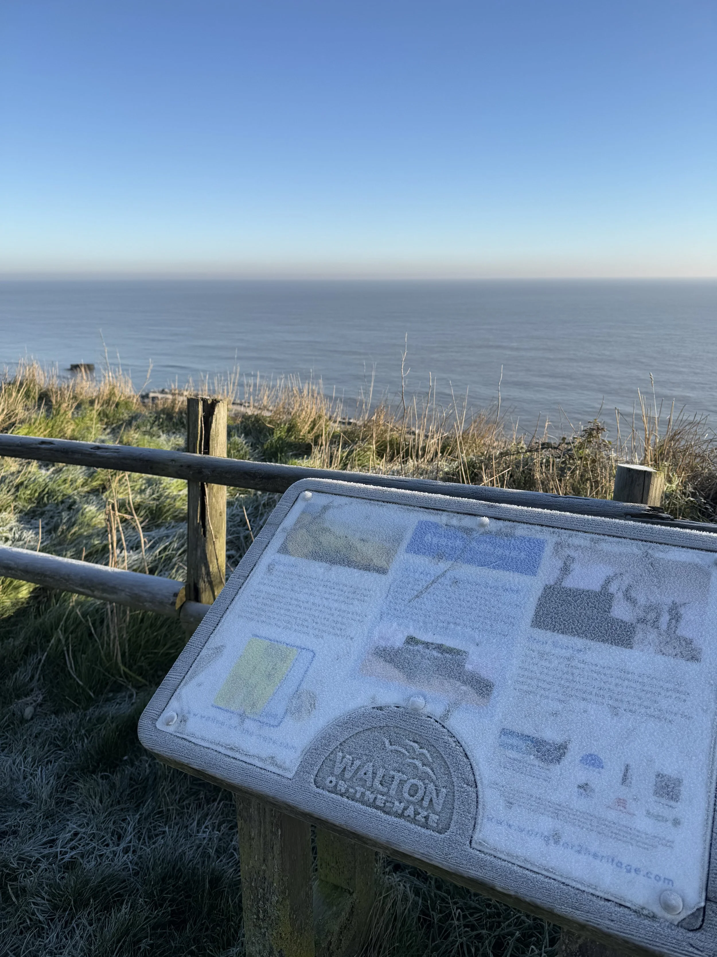
Day 3 was the coldest yet and so everyone wrapped up warm before heading on the coach to Walton On The Naze. Here we investigated how the coastal management influences the natural processes and students took it in turns to try the different data collection methods at three different sites. Although chilly, it was a beautiful day and the students threw themselves into their various different data collection roles.
Once finished it was time to head back to the coach and head back home. The trip was a resounding success and a great time was had by all. We’re hugely grateful to the staff at the FSC Flatford Mill for facilitating a wonderful trip!
Having shared what we did, it seems only right to share some WWWs and EBIs in true teacher style- in case anyone else is considering a similar trip or wants to gain ideas. So, what went well?
1. Mixing staff and students from different schools was more successful than I ever could have imagined. Staff were able to learn from each other, share ideas for future collaboration and feel part of the wider team that being in a trust can offer.
2. The quality of fieldwork by the FSC staff was excellent. We planned our trip to ensure we could get the most from their expertise and so did the urban day as Day 2 to ensure we had ample time for the GIS workshop. We self-run our other fieldwork and it’s very London-centric so to gain exposure to new environments and places such as Debham and Ipswich where they are the experts was invaluable.
3. Despite everything you read about teenagers being addicted to their phones and screens, it seems that you still can’t beat some old-fashioned fun. Watching them enjoy Uno, cards games, a quiz round and an incredibly competitive round of Dingbats was a joy. I’ll certain remember to include some organised fun for the evenings of all future residential trips.
Even better if?
1. Staff felt that they’d like to collate the hand-outs from the FSC into a booklet to maximise the quality of the note-taking by students. This is a minor change and something that might reflect our specific cohorts and contexts but we like to conduct our fieldwork in booklets that we can then give to students and say voila, in here is everything you need.
2. The different starting points of the students from different schools was a little bit of a challenge and so, in future, we’ll ensure that everyone has had the same introductory lesson before any trip. We’ll co-planning what we want them to know and have covered and try to level the playing field a little bit more. For example, we would like to ensure that all students know the components of the NEA and what make a successful NEA so that when they’re hearing about these different techniques and approaches, they can think about how they might like to use them in their coursework.
Overall however, a resounding success and something I hope to repeat in the future! Onto planning 2026…


January 15th: What is a map? A thought-provoking quote
As an avid reader, I enjoy stumbling across quotes and extracts to insert into lesson resources from KS3 right through to A-Level. Most of the time this is from non-fiction books with geographical links, lots of which are reviewed here. However, every once in a while, I come across something in a fictional book that causes me to pause, think and reflect. The quote below from The Island of Missing Trees by Elif Sharak caused me to do just that.
’Maps decide who is to be our enemy and who is to be our friend’
’Cartography is another name for stories told by winners’
I seem to be stumbling across discussions of maps and mapping a lot at the moment but I just love this quote to kickstart discussion. It’s gone straight into my A-Level lessons of 8B.4b of the Edexcel A-Level spec where we discuss national borders as a consequence of historical development- particularly colonialism.

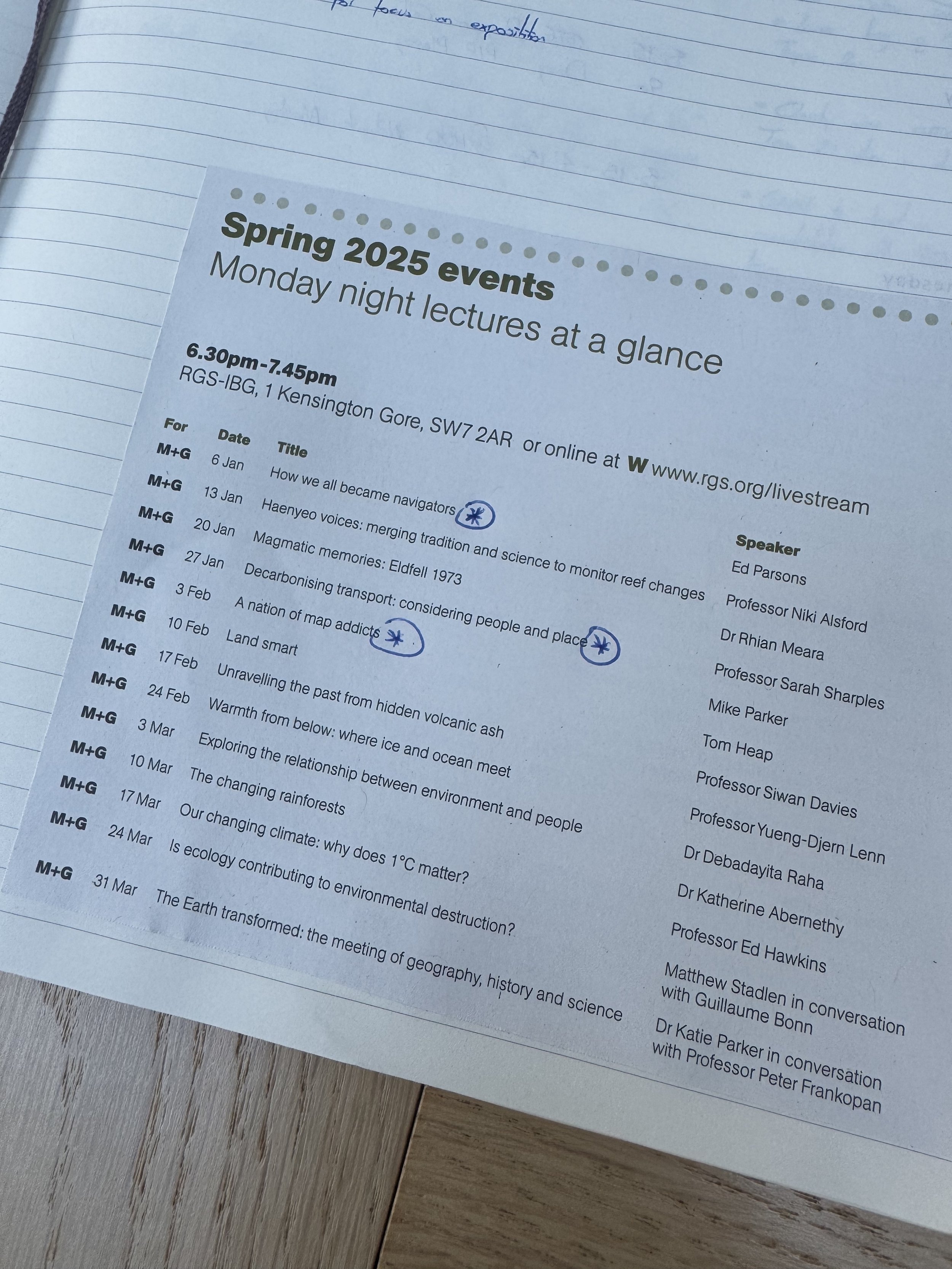
January 7th: How we all became navigators, an RGS lecture
Determined to attend, or catch up on, more of the RGS Monday night lectures this year, I got off to a good start! Last night I watched Ed Parsons deliver an excellent lecture about how we all became navigators.
Here are my key takeaways:
Maps have never been more widely used than they are today.
Despite newspaper headlines lamenting the decline of the nation’s map reading ability, we need to remember this.
We’re not just carrying maps around in our pocket pointlessly- we’re actually using them.
We are using maps, we are reading maps incredibly regularly- it’s just in a different way.
There are 2 billion users of Google maps every month.
We’ve all become navigators- we’re using maps to help us get from A to B.
But this is more complicated than it sounds. Where is A? Where am I at any particular point of time? Where is B?
But, to know where B is, we need to know where everything else in the world is. Where do I want to get to, relative to everywhere else?Our phones mean we’re getting personalised directions- taking into account our preferences for trains rather than buses, uses motorways rather than lanes. Our phones can pull up a photo of any building, pretty much anywhere in the world.
This knowledge of where things are has been embedded into other applications such as Uber and Deliveroo. All these apps use the same underlying tech: where am I? Where am I relative to everywhere else?
How did we get here? There are 2 major themes that are essential to understand in order to understand this change to mapping and our uses of maps.
1. Accessibility: something that was once only in the hands of a few people (because it was complicated or expensive) is now in the hands of everybody.
2. Technology accretion: technology has built on technology which has built on other technology to get us to this point.
Importantly, what does this mean?
These changes mean that today, as a society, we’ll never be lost.
Being lost is now an alien feeling- we can always rely on the blue dot to tell us where we are.
It’s incredible powerful in many ways- reassuring and helpful for things like the emergency services
But, just because we have that capability never to be lost, it doesn’t mean we have to use it all the time… there is value in exploring without that certainty
Naturally, having listened to the lecture, I found myself reflecting on what this might mean for our geography classrooms- especially in a time of curriculum reform conversations where mapping and geo-spatial skills are frequently mentioned.
What does this mean for our geography classrooms? My thoughts:
How do we present maps and the map skills we teach to students?
I rarely acknowledge how maps are used today and how mapping has changed in recent years with students- should we? Would this help give context to map skills and help students understand their relevance regardless of the ubiquitous use of Google and Apple maps?
Do we need to explicitly teach how modern mapping software works and the difference between app-based maps and printed OS maps? What would be the powerful knowledge in such a lesson?

January 6th: Back with bang! Delivering CPD
It was back with a bang today as I started the new term by delivering an hour of CPD to the geographers of the King Edward VI Foundation in Birmingham. I was asked to speak about what it means to think, speak and write like a geographer and I really enjoyed preparing for, and then presenting on, this topic.
When delivering sessions like this I find it useful to zoom out and start with the big picture. What does it mean to be a geographer and what are we aiming to develop in our students? I often find myself coming back to the same question: what does it mean to develop students’ ability to enquiry in the knowledge-rich age?
Delivering CPD is an element of my work that I love so if you’re interested in a CPD session, a curriculum review or assistance with one specific element of delivering the very best geography possible, please do get in touch.

January 2nd: Back to work jobs
As the festive break draws to an end, I’m slowly re-introducing the my brain to the idea of work…
On days like this, I often work through a series of (enjoyable) small tasks to ensure I feel up-to-date, on top of things and inspired for the return.
Today, this included:
1. Signing up to Alan Parkinson’s Living Geography Substack
I used to get regular email updates from Alan’s Living Geography blog and found them incredibly useful- the regular dose of geography into my inbox would keep me up to date with books recommendations, podcasts, new resources and so much more. When this email subscription stopped, I would periodically visit the site for my geographical updates but it wasn’t the same as it landing regularly into my inbox… it’s great to see that Alan has got round these issues with a Substack newsletter- sign up here: https://livinggeography.blogspot.com/2024/12/happy-new-year-please-subscribe-to-my.html
2. Making a note of upcoming Monday night RGS lectures
I’m determined to make the most of my RGS fellowship this year and get to as many of their lectures as I can. Before Christmas, I attended the lecture given by Tim Marshall and it was (predictably) excellent. It’s inspired a me to do lots more reading about space and the geography of space.
3. Catching up on some podcasts from The Economist
Lots of people know that I’m a huge fan of The Economist and have no better source for maintaining, and broadening, my subject knowledge. I listen to their free ‘The Intelligence’ podcast most days and am lucky enough to have a digital subscription through work (something our Trust recently introduced for all teachers of geography, politics and economics). I make a note of particularly worthwhile clips to share in my weekly geography bulletin that goes out to all the geography teachers of Future Academies. Today, I made a note to share this discussion of how patterns of urbanisation are changing in China- listen from 11:36 to 16:20: https://www.youtube.com/watch?v=80Yd4aMq9bo.